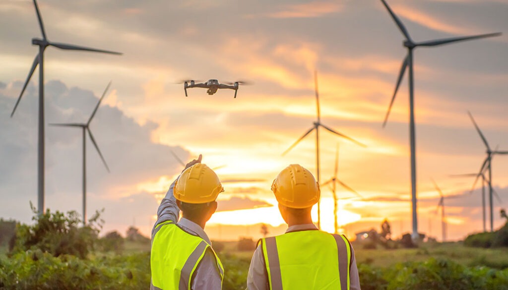
Drones have come a long way from being just hobbyist gadgets or military tools. Today, they’re revolutionizing industries, whether it’s inspecting wind turbines, mapping dense forests, or delivering medical supplies to remote villages. But what truly sets modern drones apart isn’t just their sleek design or high-speed capabilities. It’s their vision.
Enter GMSL2 cameras, the game-changer for aerial imaging. Unlike traditional camera setups, which struggle with latency, limited resolution, and interference, GMSL2 (Gigabit Multimedia Serial Link 2) technology delivers ultra-fast, high-bandwidth image transmission with near-zero lag. That means drones can see clearer, react faster, and operate more reliably, even in the most demanding environments.
So, whether you’re capturing cinematic landscapes, enhancing security surveillance, or pushing the boundaries of AI-powered autonomous flight, GMSL2 cameras are taking drone vision to new heights—literally.
In this blog, we’ll explore how this cutting-edge tech is reshaping the future of aerial imaging.
What is GMSL2 and Why It Matters for Drones?
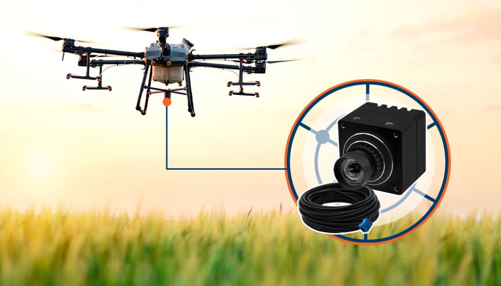
An industrial drone
Gigabit Multimedia Serial Link 2 (GMSL2) is a high-speed, long-distance data transmission technology designed to handle real-time video streaming with minimal latency. Originally developed for automotive applications, GMSL2 cameras have now found their way into drones, offering unparalleled performance in aerial imaging.
Unlike traditional camera interfaces like MIPI CSI or USB, which struggle with limited cable lengths, GMSL2 supports data transfer speeds up to 6Gbps over a single coaxial cable (up to 15 meters).
This not only ensures ultra-fast, high-resolution video transmission but also allows for Power over Coax (PoC), reducing the need for additional power lines and simplifying drone design.
For drones, where every millisecond matters, GMSL2 cameras provide low-latency, high-bandwidth connections, making them ideal for FPV (first-person view) flying, AI-driven navigation, and high-resolution surveillance.
Compared to conventional interfaces, GMSL2 excels in long-distance data transmission, robust electromagnetic interference (EMI) resistance, and seamless multi-camera synchronization—all critical for pushing the limits of aerial vision.
Key Advantages of GMSL2 Cameras in Drone Applications
Let’s break down the key advantages that make GMSL2 cameras a game-changer for aerial imaging and real-time data processing.
Low Latency for Real-time Processing
Drones relying on FPV, autonomous navigation, or AI-based object detection need instantaneous data processing to make split-second decisions. GMSL2 ensures that high-resolution video feeds reach the processing unit with minimal delay, preventing lag that could lead to crashes or missed targets. Whether it’s a racing drone zipping through obstacles or a delivery drone avoiding power lines, real-time vision is crucial.
High-resolution Imaging Over Long Distances
With support for 4K HDR video transmission, GMSL2 cameras maintain exceptional clarity and color accuracy even at extended cable lengths. Unlike USB or MIPI interfaces, which degrade over long distances, GMSL2 preserves image quality, making it perfect for mapping, surveillance, and inspection drones that require detailed imaging from high altitudes.
Power Over Coax (PoC) for Simplified Wiring
Traditional camera setups require separate power and data cables, adding weight and complexity to drones. GMSL2’s Power over Coax (PoC) feature eliminates extra wiring, allowing drones to be lighter, more efficient, and more power-optimized—critical for maximizing flight time. A leaner setup also improves aerodynamics and reliability, reducing points of failure.
Robust EMI Resistance for Stable Performance
Drones operate in noisy electromagnetic environments, often near radio towers, high-voltage lines, or industrial machinery. Traditional camera interfaces struggle with signal interference, leading to video glitches or loss of feed. GMSL2’s superior EMI resistance ensures a stable, interference-free connection, making it ideal for drones operating in challenging conditions.
Use Cases of GMSL2 Cameras in Drones
Let’s explore some of the most impactful use cases where GMSL2 cameras are making a difference:
Autonomous Drones & AI-based Navigation
As drones become increasingly autonomous, their ability to perceive and react to their surroundings in real-time is critical. GMSL2 cameras provide high-speed, low-latency video feeds that enhance AI-driven navigation. With real-time image processing, drones can detect obstacles, assess terrain changes, and make split-second adjustments to their flight path.
This is particularly beneficial for drones operating in complex environments like urban areas or dense forests, where precise maneuverability is required. Whether it’s for search and rescue missions or automated aerial surveillance, GMSL2 cameras ensure drones can “see” and respond instantly, reducing the risk of collisions and improving overall flight efficiency.
Surveillance & Security Applications
Security and defense organizations rely on drones for real-time surveillance, reconnaissance, and threat detection. GMSL2 cameras provide high-resolution imaging, enabling law enforcement agencies and military personnel to capture detailed visuals from high altitudes. These cameras support 4K HDR streaming with minimal signal degradation, ensuring that critical details, such as license plates, facial recognition, or suspicious movements, are clearly visible even from a distance.
Additionally, the robust EMI resistance of GMSL2 cables ensures stable video feeds in high-interference environments, such as urban centers or military zones. With real-time data transmission and AI-enhanced object tracking, drones equipped with GMSL2 cameras are becoming indispensable tools for national security and public safety operations.
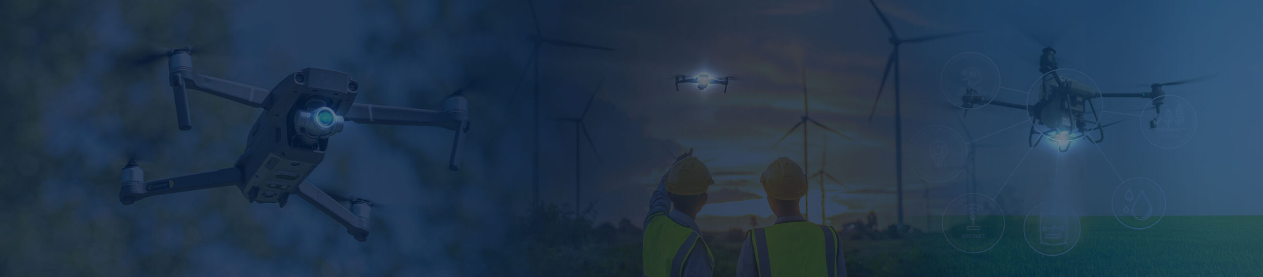
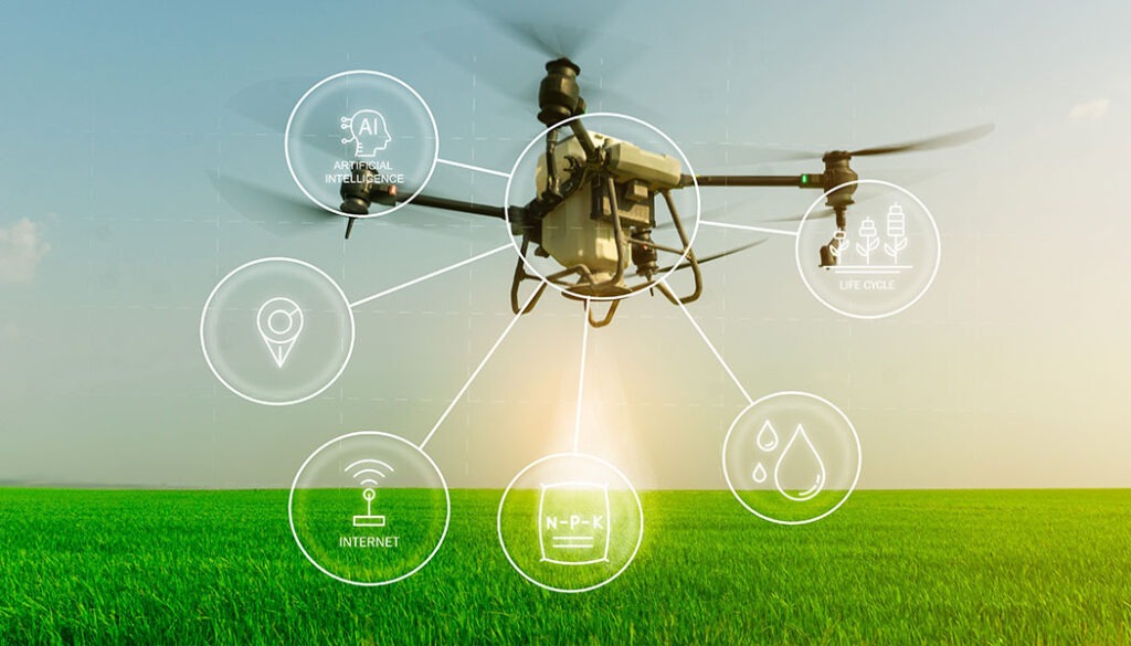
Agricultural Drone Imaging
The agricultural industry is rapidly adopting drone technology for precision farming, and GMSL2 cameras are playing a crucial role in this transformation. Equipped with multispectral and high-speed imaging capabilities, these drones can analyze crop health, detect irrigation issues, and identify pest infestations with unparalleled accuracy. The high bandwidth of GMSL2 ensures real-time transmission of large volumes of imaging data, allowing farmers to make informed decisions quickly.
For example, drones can scan vast fields and generate detailed NDVI (Normalized Difference Vegetation Index) maps, providing insights into crop vitality. With better aerial visibility and real-time data processing, GMSL2-powered drones are optimizing agricultural practices, reducing waste, and improving yield predictions.
An agricultural drone
Delivery Drones & Logistics
The rise of drone-based delivery services demands highly efficient imaging systems to ensure accurate package handling and precise landing. GMSL2 cameras enhance package detection by providing high-resolution, real-time visual feedback to the drone’s AI system. This allows for precise object recognition, ensuring that deliveries are placed correctly even in challenging environments such as apartment balconies or narrow drop-off zones.
Additionally, the low-latency nature of GMSL2 technology enables drones to adjust their positioning in real-time, reducing landing errors and enhancing safety. As companies like Amazon, UPS, and medical supply chains push the boundaries of drone logistics, GMSL2 cameras will be essential in ensuring smooth, efficient, and secure deliveries.
Mapping & Inspection
Infrastructure maintenance and geographic mapping require drones with advanced imaging capabilities, and GMSL2 cameras are ideal for these applications. Whether inspecting bridges, power lines, oil pipelines, or remote terrains, these cameras provide high-speed, high-resolution imaging that ensures accurate data collection.
The ability to transmit ultra-clear images in real time allows engineers and surveyors to detect structural damage, corrosion, or other issues without requiring costly manual inspections. Additionally, for topographic mapping and environmental monitoring, drones equipped with GMSL2 cameras, in combination with 3D cameras like stereo or time of flight, can capture detailed 3D terrain models with incredible precision, aiding industries such as construction, mining, and environmental conservation.
Engineering a GMSL2 Camera System for Drones
Several factors need to be taken into consideration when choosing a GMSL2 camera for a drone system. This includes:
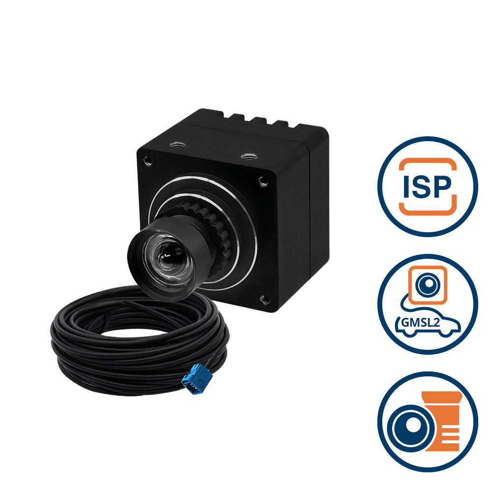
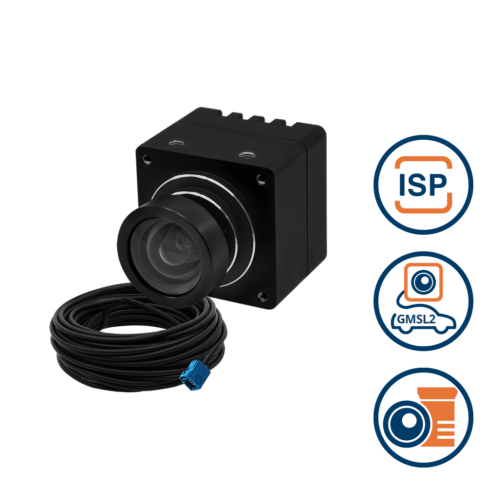
Choosing the Right GMSL2 Camera Module
Selecting the ideal GMSL2 camera module for a drone depends on factors like resolution, frame rate, lens type, and environmental durability. High-resolution 4K cameras with HDR capabilities are essential for applications requiring detailed imaging, such as surveillance and mapping.
For high-speed tracking, a module with a high frame rate (60+ FPS) ensures smoother video output. TechNexion offers a range of GMSL2 camera solutions that cater to these needs, providing rugged designs suitable for various drone applications.
Integrating GMSL2 with Flight Control Systems
To maximize the potential of GMSL2 cameras, they must be seamlessly integrated with a drone’s flight control system. This involves synchronizing video feeds with GPS, LiDAR, and onboard AI for real-time decision-making. Proper sensor fusion ensures accurate object detection, collision avoidance, and autonomous flight adjustments, enabling drones to operate efficiently even in dynamic environments.
Optimizing Data Transmission for Edge AI Processing
GMSL2’s high-bandwidth capabilities significantly reduce latency in vision-based AI processing. However, optimizing the data pipeline is crucial to prevent bottlenecks. Edge AI processors onboard the drone must efficiently handle image compression, object recognition, and predictive analytics without overwhelming computational resources.
Testing & Calibration for Best Performance
Fine-tuning a GMSL2 camera system involves calibrating lens distortion, adjusting exposure settings, and testing under different lighting conditions. Rigorous field testing ensures that the camera delivers optimal performance in real-world scenarios, from urban landscapes to remote environments. Proper calibration enhances image clarity, minimizes artifacts, and ensures consistent performance across diverse drone applications.
The Future of GMSL2 Cameras in Drones
As drone technology advances, GMSL2 cameras are poised to play an even greater role in pushing the boundaries of aerial vision. Future developments will focus on higher-resolution imaging, enhanced low-light performance, and even greater AI integration for real-time decision-making.
With the rise of 6G connectivity and edge AI, drones will be able to process massive amounts of visual data faster than ever, enabling near-instantaneous object recognition, obstacle avoidance, and autonomous mission planning.
Moreover, miniaturization and power efficiency will be key trends, making GMSL2 camera systems even more lightweight and optimized for long-endurance flights. Industries like smart cities, disaster response, and precision agriculture will increasingly rely on these advanced vision systems for automated operations.
As the technology keeps improving, GMSL2-powered drones will unlock unprecedented levels of autonomy, intelligence, and imaging precision, transforming the way we capture, analyze, and act on aerial data.
Wrapping Up
GMSL2 cameras are revolutionizing drone imaging by delivering high-speed, low-latency, and high-resolution video feeds essential for AI-driven aerial applications. From autonomous navigation and security surveillance to precision agriculture and industrial inspections, GMSL2 is redefining what drones can see and do. As industries push for more advanced vision-based AI, the need for reliable, high-performance imaging solutions will only grow.
For developers and drone manufacturers looking to stay ahead, integrating GMSL2 cameras is the next step in innovation. Explore TechNexion’s cutting-edge GMSL2 camera solutions and unlock the full potential of aerial vision technology today! For more information, feel free to get in touch with us.
Related Products

Get a Quote
Fill out the details below and one of our representatives will contact you shortly.